
Fabrizio del Wrongo writes:
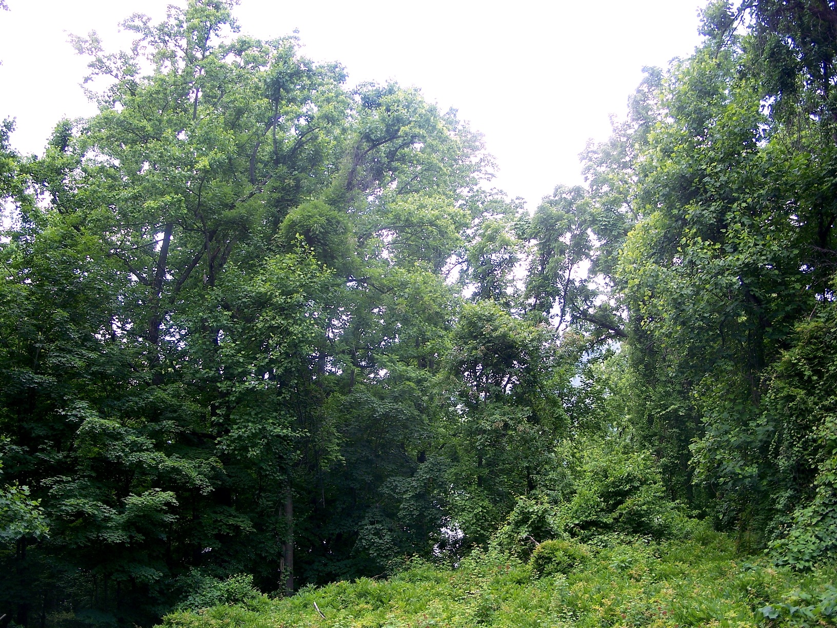
I had some time off from work recently, so, semi-active, nature-lovin’ guy that I am, I decided to do a little hiking. I try to go hiking a couple of times a year. I find that getting out into nature for a few hours is sort of . . . recalibrating — like an enema for the soul. Corny, right? But, hey, it’s good to be corny about some things, nature being one of them. It’s better than being corny about cats.
Another nice thing about hiking: it helps reorient you. This is especially true if, like me, you live in an area rich in weird nooks and crannies. This time around I decided to hike around the village of Cold Spring. Located on the east side of the Hudson River, Cold Spring sprung up around the West Point foundry, which was established in the early part of the 19th century to provide artillery to the federal government. These days it mostly serves as a charming little getaway for NYC folks who want to go antiquing and gawk at the local scenery. It’s a fairly quick train ride from Manhattan.
The trail I took starts a bit outside of town, perhaps a mile north of the village on Route 9D. It crawls up and over the hills surrounding Cold Spring, eventually looping over the wonderfully named Breakneck Ridge, a mountain that, along with Storm King on the west side of the river, forms a distinctive natural gateway to one of the most scenic bits of the Hudson Valley. An area old-timer once told me that Breakneck was named for the demise of a semi-wild bull that once roamed the hills around here — one which fell off the mountain one day, dying from a broken neck. This site suggests a different origin:
There is an old Lenape (Indian) story that somewhere in these hills was the last haunt of the feared and ferocious Great Naked Bear, a species that ate humans. Hairless except for a tuft of white hair on the back, they originally lived over a wide area of Turtle Island (North America). Because their hearts were too small to aim at with a spear, they were almost impossible to kill. They could smell a solitary human all the way from the other side of the mountain, and villages were never safe from their attack. Nonetheless one by one they were hunted down and destroyed, until only one remained on the east banks of the Hudson. A hunting party climbed a steep cliff for protection (the Breakneck Ridge). When the creature attacked from below the men threw boulders, crushing its skull and breaking its neck.
I think I like the Indian story better, though they’re probably both bullshit.

The first interesting site on the hike is an old granite quarry, long abandoned. Gravel still covers the ground, giving the location a vaguely lunar quality, even in spite of the scrub that’s grown up. In the above photo I’m standing on a pile of the stuff. You can see a girl hiker way back in the distance. She and her friend were out walking their pit bull mix and yammering out a running commentary to their friend via a cell phone video chat application. Grrr.
Stone culled from sites like this was used to build a lot of historic structures in this area, including the Brooklyn Bridge. That kind of activity leaves a mark: you can still see the scars left on the landscape by all that blasting. Fortunately, local big wigs, dismayed by what was being done to their beloved views, got together in the ’30s and formed The Hudson River Conservation Society. The Society then purchased a lot of this land and gave it to the government. I’m guessing that constitutes one of the early triumphs of environmental conservation in America.

The trail loops up and around the quarry. Here’s a shot looking down. The hike took place in mid-June, during the height of the 2013 Brood II cicada infestation, and the air was thick with the sound of trilling insects. That combined with the natural weirdness of the place gave this location an almost surreal air — I kept flashing on that Peter Weir movie about the girls who get lost hiking in the Australian outback. It didn’t hurt that I could year the voices of the Yammer Twins echoing around the disorienting din of the cicada buzz. You can make out one of them in the above photo, on a path in the lower left quadrant of the image. I didn’t see them again. Possibly they lost cell phone reception and went home.
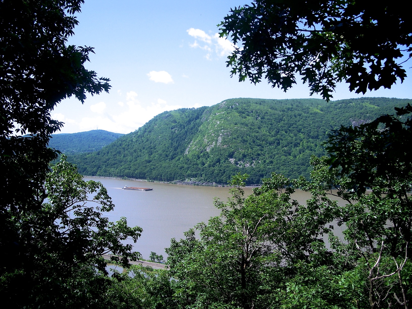
The first good view is available directly across from the quarry overlook. That’s Storm King Mountain on the west side of the Hudson. At somewhere around 200 feet, this is about the deepest segment of the river. Formed by glaciation well over 10,000 years ago, the Hudson is actually a tidal estuary; the water in the lower part of the river is brackish, and it’s subject to tides, meaning it flows both ways — sort of like John Travolta.
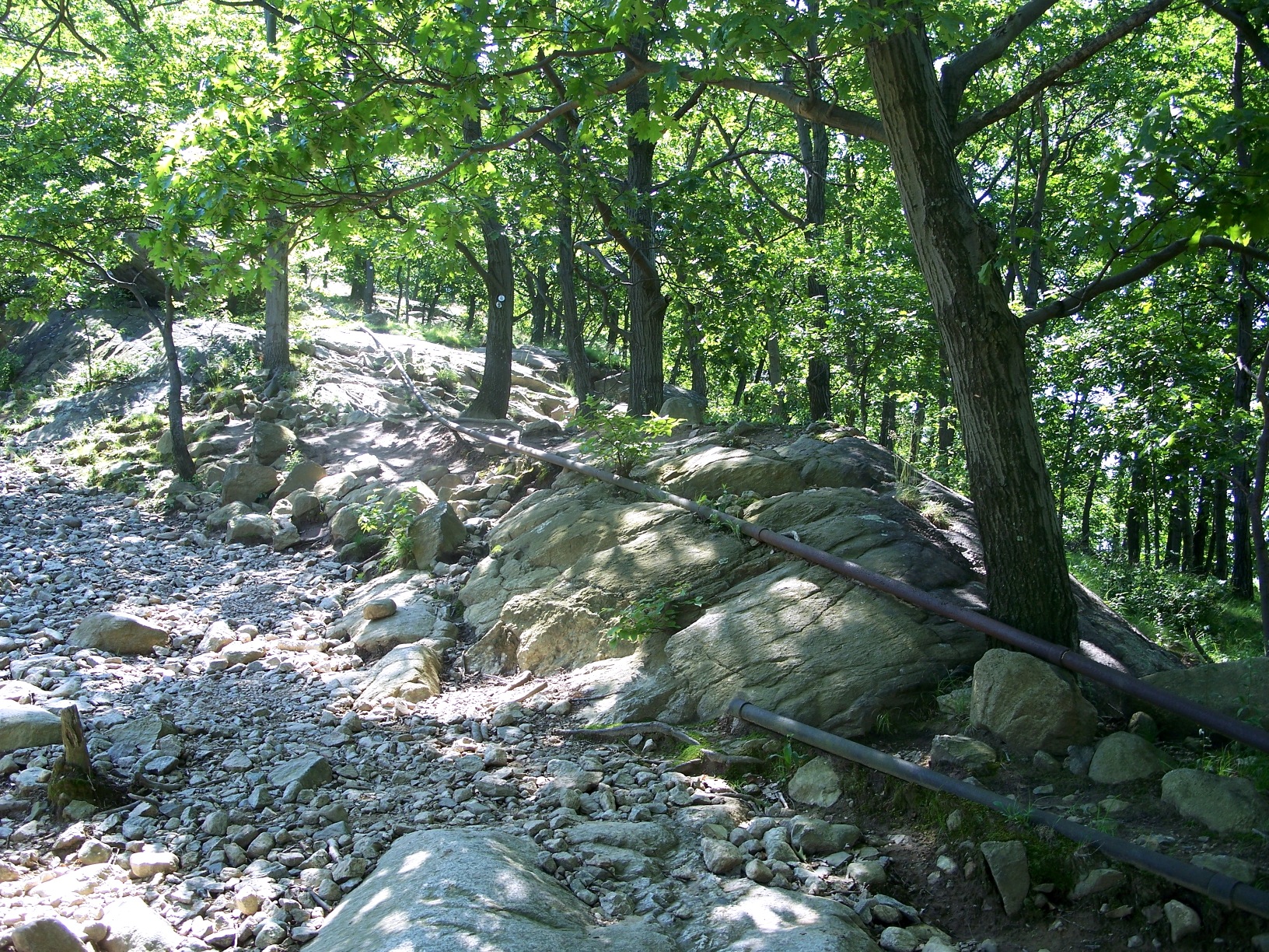
There are still some old pipes running into the quarry. It must have been quite a project getting trucks and water and power back into the woods to get all that rock. A road back into the woods must have been constructed, but I didn’t see evidence of one.

The second good view occurs at a rocky overlook a bit up from the quarry. That’s Cold Spring down below.

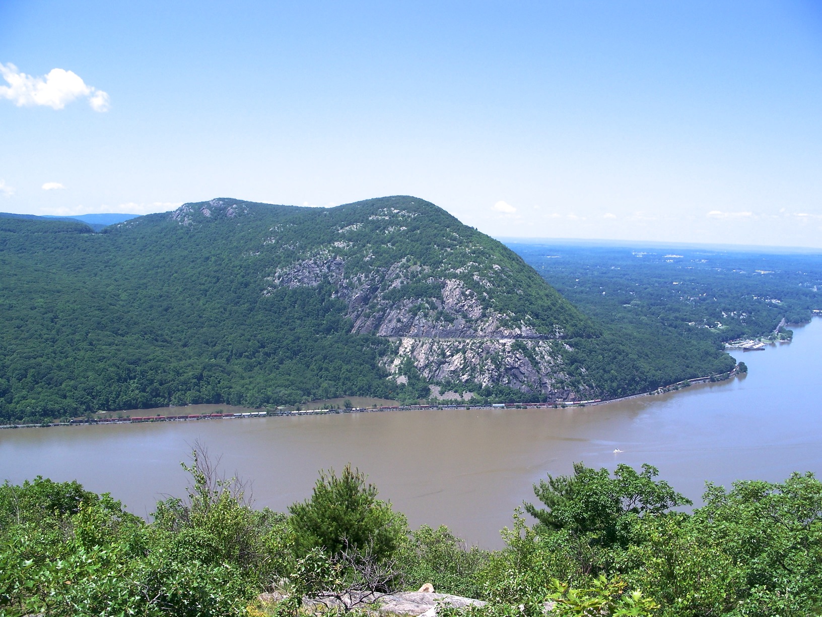
The trail then progresses upwards, switching back to give you this similar view from a higher vantage point. That jutting bit of land you see on the far side of the river is West Point, aka The United States Military Academy. Before it was a training school for Army officers it was a fortress designed to block British access to the Hudson during the Revolutionary War. Its location was strategic: that bend in the river forced vessels to slow down, which meant they could be more easily bombarded by artillery emplacements on both sides of the river. In order to further impede access a giant iron chain was forged and floated across the river at two locations in the bend. Today, a section of the chain is on display at West Point.
Across the river from West Point is Constitution Island. Late in the Revolutionary War both it and West Point were under the command of Benedict Arnold, one of the rebels’ bravest and most successful generals. When Arnold was caught scheming to turn the area over to the British — a plan that, had it succeeded, might have led to the capture of George Washington — he escaped across the river to Garrison, then rendezvoused with the Brits a bit south in Croton. It’s a view that takes in a good bit of history. And it’s somewhat comforting to know that it doesn’t look all that different today than it did 200 years ago.
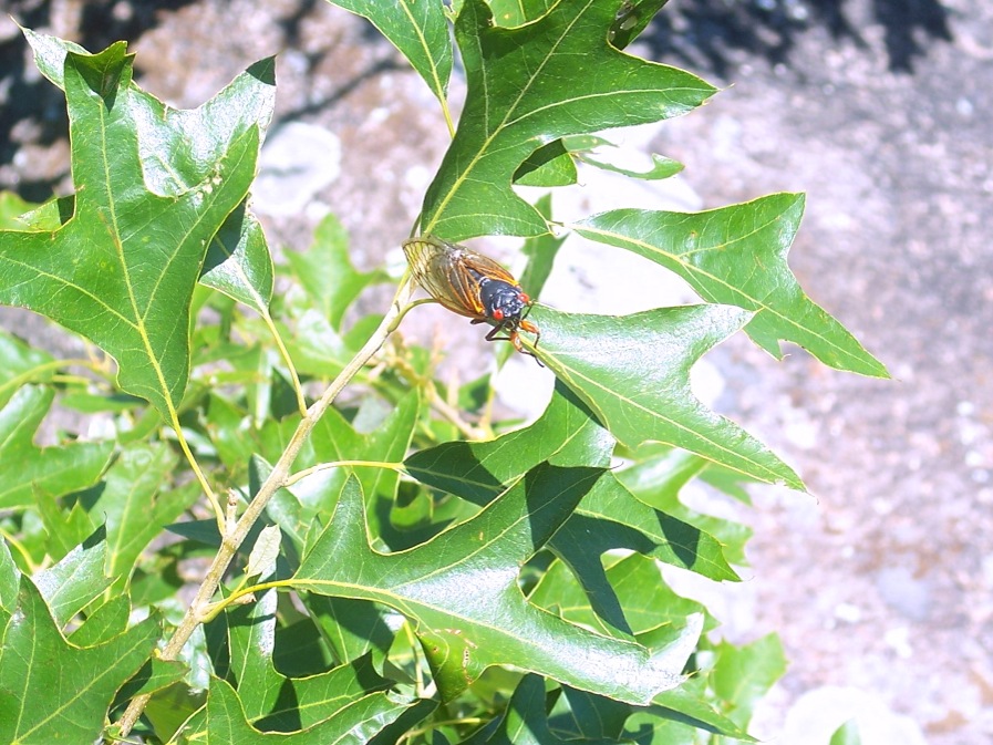
Near the top of the hill the cicada sound was deafening. Literally deafening. Those little buggers seem to instinctively seek the highest trees possible, and they were fighting for access to the trees on the hill’s crest. One landed on my backpack and started singing. Sounded a bit like a cassette fast forwarding. All the cicadas are dead now.
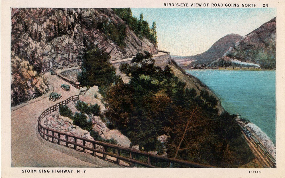
Here’s a shot looking north up the river, towards Newburgh, New York. That cut you see running through Storm King Mountain is Storm King Highway. One of the oldest public roads in the area, it was built in the early ’20s to connect West Point to the towns directly north. It was quite an engineering project at the time. The road remains pretty dangerous due to rock slides, but it provides some great overlooks. Here’s what it looked like back in the day.
You can also make out a train running below the mountain. These days, the tracks on the west side of the river service freight trains exclusively, but prior to 1950 the New York Central Railway used those tracks to transport people into western New York all the way to Buffalo.

This shot shows the tracks on the east side of the river. At one time they were part of the Central Railroad’s “Water Level Route,” which ran up the Hudson into western New York and all the way to Chicago. It’s on this route that Cary Grant meets Eva Marie Saint in “North By Northwest.” If you look closely at the movie you’ll see shots of this part of the Hudson projected behind their heads while they’re dining.
The island visible behind the mountain is Pollepel Island. Once owned by a Scottish arms merchant named Francis Bannerman, it’s famous for its weird, vaguely Scottish-looking castle, which Bannerman built to store his arsenal and advertise his business. It exploded some time around 1920, taking a fair bit of the island along with it. But that just added to the haunting, ruinous aspect of the place. Sadly, time and weather have gradually ruined the ruin, and it’s in danger of collapsing into the water. There are tons of photos on the web.
By the way, this is around where the Catskill Aqueduct crosses under the river. The aqueduct supplies about 40% of New York City’s water. In the movie “Die Hard: With a Vengeance,” the bad guys plan to escape to the Catskills using the New York water system as their getaway.

It’s somewhat rare to run into large mammals while hiking around here, but you do see plenty of amphibians and reptiles. This eastern American toad was just chillin’ in the middle of the path. Looks like he’s fattened up on dying cicadas.

I also ran across a few of these five-lined skinks. This is an adult. The juveniles have prominent stripes and bluish tales. I’ve been seeing more and more of these lately, which must mean something, environmentally speaking. It’s not uncommon to see rattlesnakes around here. Thankfully, I didn’t run into any of those.

This simple wooden bridge spans Breakneck Brook, which divides Breakneck Ridge from Bull Hill. I’ll take this as an opportunity to thank all the volunteers who maintain these trails and associated structures.

A shot of the brook.
Once you cross the bridge the toughest part of the hike up Breakneck begins. I have bad knees, and I was feeling pretty sore by this point, so I went a little ways up the hill, then turned back. While resting on a boulder, I went to wipe some sweat off my brow and inadvertently knocked my glasses down into a crevasse. You’ve never heard someone curse so loudly. “This,” I thought, “is exactly how those man-against-nature horror movies start off.” I did manage to find my glasses, but only after much climbing and considerable worrying.
Fortunately, a blue-blazed trail breaks off from the yellow-blazed main trail at the bridge. It heads back toward Cold Spring, and it’s a pretty easy walk; much of it transverses what seems to be an old forest road, some of it paved with gravel.

This old pumping station is located beside the brook. I was a bit mystified by it at first. What property did it service?

Another mystery, located a couple of hundred yards from the pumping station. An old reservoir, I guess?

I stared down into the reservoir for a good half a minute before my eyes were able to pick out these guys. First I saw one, then two or three, then dozens — a whole troupe of murderous black bullfrogs. The water level was probably a good six feet below the lip of the stone structure, so I don’t think they were capable of leaving. They probably live their whole lives down there in that ooze. Lord knows what they eat. Possibly each other.

I think the black hue is due to the lack of sunlight and the dark color of the water. Bullfrogs will change color depending on their surroundings. As you can see there were also some smaller green frogs, the most common type of large frog in these parts. I imagine that during breeding season this little structure becomes a sort of frog Thunderdome. That night I had a nightmare about falling in and not being able to climb out.
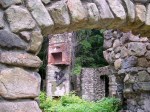
I figured out what the pumping station and reservoir were for a little later when I came across the ruin shown in the below gallery. From the look of it, it’s been abandoned for quite some time.
-

- Porte Cochère
-

- Back of the Mansion
-
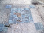
- A Decorative Patio Element
-
- Interior
-
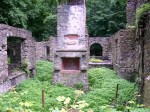
- Interior
-
- Interior
-
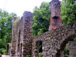
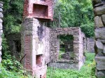
- Front Walls
When I got home I did some Googling and discovered that the ruin is all that remains of the Cornish family mansion, called Northgate. In the ’20s Edward Cornish presided over the National Lead Company; he purchased the home from a diamond seller named Sigmund Stern. After his death the home fell into disuse, then was razed by a fire in the ’50s. Apparently, there’s a ruin of the Cornish dairy farm back in these woods as well, though I didn’t come across that. You can read more about the ruin at Hudson Valley Ruins. The site also has some very interesting photos of the estate as it looked in its heyday. It’s amazing to see the location with a manicured lawn and a view of the Hudson. See below to get an idea what that view looks like today.
Related:
- In case you need more info on this hike.
- Bitchin’ panoramic photo of the area.
- TimeOut on Cold Spring.
- Some tantalizing tidbits regarding lost crap in the region.
- Some nice history concerning the “Water Level” train route.
- Cicada epic.
- Bullfrogs are fucking terrifying.

Awesome tour. I’ve been meaning to tell you, I read a graphic novel a few months ago that takes place in your neck of the woods — a Gilded Age fantasy-mystery-romance that I enjoyed: http://www.amazon.com/Sailor-Twain-The-Mermaid-Hudson/dp/1596436360/
LikeLike
Book sounds interesting. The River certainly has its fantastical, Flying Dutchman qualities…
LikeLike
Great photo tour. It’s a surprisingly gorgeous part of the world, and the Indian/Dutch/Federal/Washington Irving quality of the area casts a potent spell. I’m one of those annoying Manhattanites who gets away to Cold Springs every few years. During one of those stretches when NYC life was driving me crazy I was semi-serious about moving to Cold Spring. The commute to work would have been long but …. nature! Quiet! We should join up and do some (modest) hiking together sometime.
LikeLike
I’d love that. Just let me know. Cold Spring is a lovely little place. It’s about the only Hudson Line stop I can think of that’s a destination in and of itself. All the others are big commuter parking lots.
LikeLike
Nice write-up! Even though the cicadas are gone, the area is still teeming with insects since we got so much rain in May & June. I tried hiking a familiar trail in NJ last weekend and turned around; it felt like the Congo.
LikeLike
East-coast humidity can definitely put a damper on one’s hiking enjoyment.
LikeLike
Pingback: Father Knows Best: Weird Asian Nazi Fetish Edition | Patriactionary
Pingback: Architecture Du Jour: Cold Spring, NY | Uncouth Reflections